
A place where history, architecture and nature meet
The area
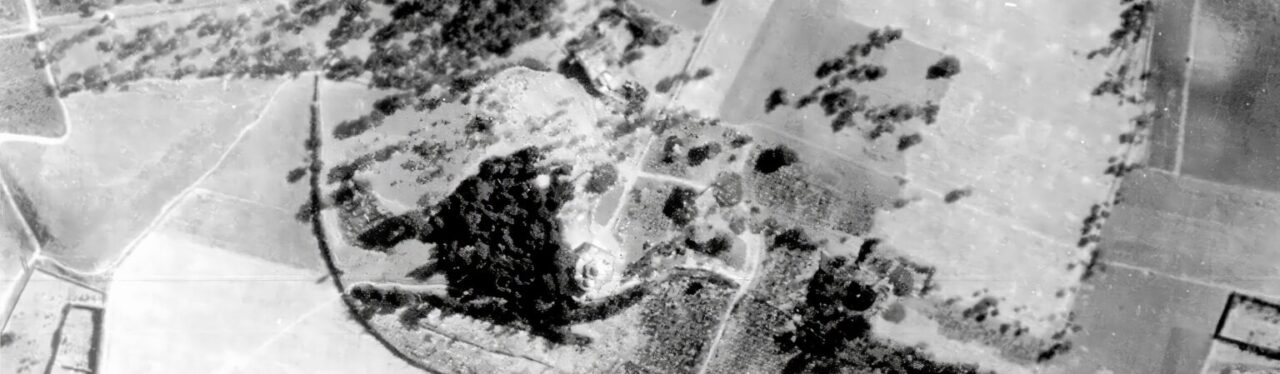
In the territory of Campi Salentina, along the ridge of the Serre di Sant’Elia, lies a place with a character of its own. The particular shape of the land and, above all, its topography have helped create a concentration of quiet and often hidden buildings – places of faith and devotion that have been preserved over time as precious reminders of the area’s history and spiritual heritage.
In Puglia, and especially in Salento, historic and artistic heritage can be found almost everywhere. Churches, rural chapels and underground sites appear throughout the landscape, telling the story of a past that is still very much alive.
These are places where history, art and faith come together and created a landscape of great character and beauty over the centuries.
The area is now known as “Madonna dell’Alto”, after the church that stands here. Over the centuries, the church and the area have also been known by other names, including “Bagnara”, “Santa Maria de Bagnara” and “Madonna del Latte”.
It is in honour of this historic name that the park was called the “Madonna dell’Alto Rural Park”. Its identity is closely connected to the place where it stands, with the woodland forming the natural link between its different elements.
The history
A brief look at the history of Puglia and Salento helps us understand the historical and cultural setting in which the medieval religious buildings developed, including the church of Madonna dell’Alto and, later, the neoclassical rural residences built between the late 18th and 19th centuries.
This historical background allows us to see the park not only as a collection of separate buildings and features but as a single historic landscape in which nature, architecture and human stories have been intertwined for centuries.
Apulia et Calabria
Perhaps, because of its pleasant climate and fertile land, “Japigia” – the Greek name associated with the Latin “Apulia” – became, from ancient times onwards, a destination for pre-Hellenic peoples from the Balkans, particularly ancient Illyria, who may also have had links with Crete.
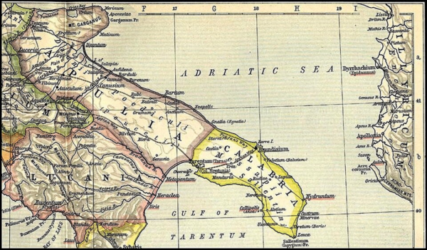
These peoples mixed with the local population and formed some of the first pre-Roman settlements in the Salento peninsula, resisting Greek colonisation as well.
– The Iapygians (northern Puglia – Apulia) were divided into Daunians and Peucetians. They were early Messapian-related cultures who lived in caves and huts and used flint weapons for hunting (9th–8th centuries BC).
– The Messapians, of Greek origin (7th–6th centuries BC), settled in southern Puglia, in what is now Salento, then known as Calabria, and subdued the earlier populations. Some evidence of the Messapian period can still be found in the remains of fortified towns such as Vereto, or Veretum, which played an important role in trade with Greece, and Rudiae, to name just two examples.
– The Sallentines, or Salentines, were associated in legends from later centuries with the origins of the modern name Salento. Some stories linked it to Salentia, a city in Crete, others to the Cretan captain Salento, or even to Sale, son of the King of Crete, who was said to have settled here many years before the Trojan War, attracted by the fertility of the land (10th century BC).
From Romanisation to the barbarian invasions
The gradual Romanisation of the area, beginning in the 3rd century B.C., marked the decline of these earlier civilisations. The Romans incorporated them into their territories and reorganised the Messapian centres, bringing them into the Roman administrative, religious and political system and radically changing their way of life.
The original language, strongly influenced by Greek, was gradually replaced by Latin. Over the course of several centuries, Messapian identity was absorbed into the Roman world, although important traces of its earlier culture survived.
From the 4th century onwards, however, Roman power in Italy began to weaken, leading eventually to one of the most important turning points in European history: the fall of the Western Roman Empire in 476 AD.
Odoacer, a Germanic military leader serving in the Roman army, successfully led a revolt by Germanic troops in Italy against the general Orestes, who effectively ruled the Western Empire through his young son, the emperor Romulus Augustulus. Orestes was killed while Romulus was sent into exile.
Odoacer then proclaimed himself King of Italy. Although he was a Germanic ruler, he retained much of the Roman administration, worked with the Senate and preserved many of the existing institutions, as well as the Roman religion and language.
In reality, Odoacer’s rise simply made visible a crisis that had been developing for decades. Economic problems, political instability, civil wars and pressure from Germanic peoples had already seriously weakened the Empire.
Zeno, emperor of the Eastern Roman Empire, later sought to regain control of the western territories through the Ostrogothic king Theodoric. Theodoric led an expedition against Odoacer and, after achieving his goal, settled in Italy in 493, ruling for the following thirty years.
Theodoric’s death, six years after the construction of his impressive Mausoleum in Ravenna (built in 520 AD and now a UNESCO World Heritage Site), provided an opportunity for the Byzantine Empire, under Justinian, to attempt to regain control of Italy.
Lombard and Byzantine rule
The Middle Ages were not only marked by long periods of conflict between Goths, Byzantines, Lombards and Normans. The main Roman roads, including the Appian and Trajan’s Ways, as well as the old Messapian routes, were also used to move troops across the Italian peninsula.
The period was also marked by outbreaks of plague and famine which severely affected Southern Italy from the middle of the 6th century to the middle of the 7th century. In Italy alone, the bubonic plague is estimated to have killed around three million people. It was probably brought by black rats arriving from Africa and reaching the Mediterranean through commercial shipping routes.
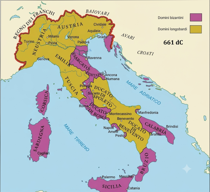
After this long period of hardship, the Byzantine army continued its efforts to regain control of Puglia, while also fighting Arab and Balkan forces. Following the death of Justinian, the Lombards arrived in Northern and Central Italy, including the Duchy of Spoleto, and later in Northern Puglia and Northern Salento, which came under the Duchy of Benevento. The southernmost part of the region, however, remained entirely under Byzantine control.
In the local countryside, farmers had to protect their small properties as best they could, forming a kind of defensive militia. It was probably in this context that the “Limitone dei Greci” was built or established. According to some scholars, a particular trace of it can still be found in the area around Sava.
This fortified line, thought to date from between the 7th and 9th centuries, is believed to have extended for more than two kilometres. It was made of large blocks of limestone and may have been around 3 metres high and between 4 and 8 metres wide.
It has also been suggested that it included watchtowers and stairways leading to the top, making it easier to defend the area against the Lombards in the 7th century and the Arabs in the 9th.
This historical and geographical context has led to theories, although there is no strong evidence that some of the churches and buildings in the area may have been connected to the walls of the Limitone. These include the church of Santa Maria dell’Alto in Campi, the church of San Pietro di Crepacore in Torre Santa Susanna and the Tempietto di Miserino in San Donaci.
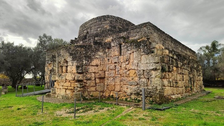
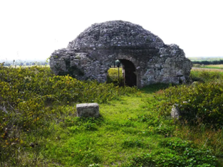
These buildings are located along an imagined boundary whose physical existence remains uncertain. The idea was put forward – or, according to some interpretations, “invented” – at the end of the 19th century by the Salento historian Antonio Profilo and the story of the Limitone still lies somewhere between historical evidence and legend.
Based on these interpretations, some ruined walls with a fortified appearance were identified as the remains of Profilo’s now-famous “Limitone dei Greci”. The line was thought to begin at Torre Santo Stefano near Otranto, continue north of Lecce through the territories of Mesagne and Oria and eventually reach the coast of the Gulf of Taranto.
According to the historian, the “Muro Magno” was a substantial structure. In some sections, particularly around Sava, it is thought to have been as much as 7 or 8 metres wide and 3 or 4 metres high. Profilo interpreted it as a territorial boundary established at the end of the long struggle between the Lombards of Benevento and the Byzantines in the 8th century.
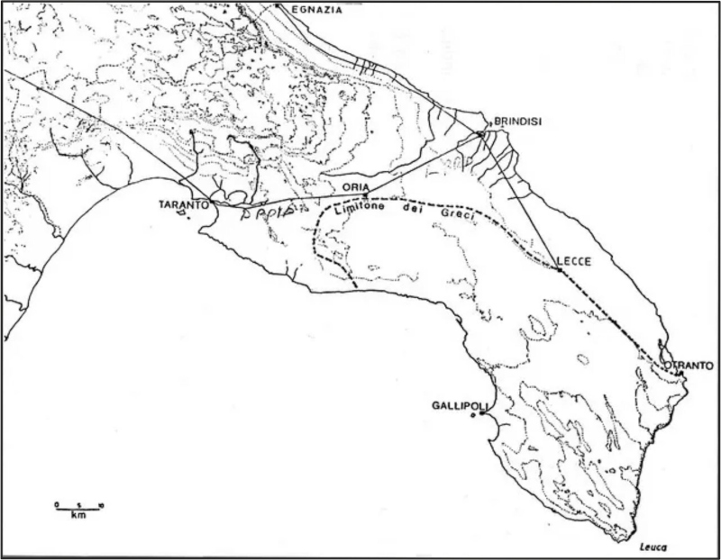
In practical terms, this long boundary was thought to mark the areas of influence of the two peoples in Southern Puglia, with the Northern part of Salento assigned to the Lombards and the southern part to the Byzantines.
Later, these ruins also convinced the respected local historian Cosimo De Giorgi that he had identified traces of the structure among some farmsteads near the Oria–Cellino San Marco provincial road. He described them as “rough stones” that had been reduced to “modest proportions… covered with wild grass”.